Weddings require flexible and well-planned photography coverage. Services are usually customized based on the number of events and days.

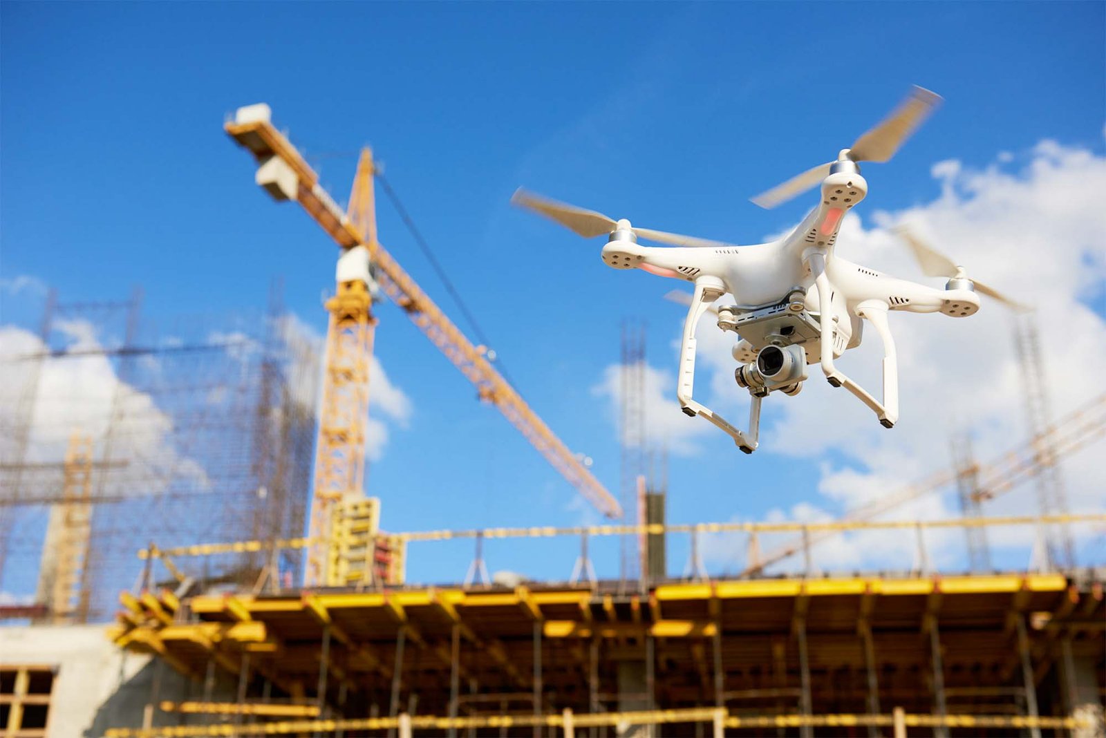
Professional Aerial Photography & DGCA-Compliant Drone Services for Construction Projects
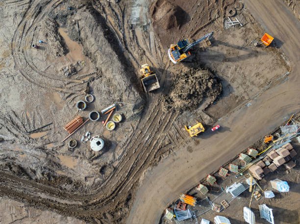
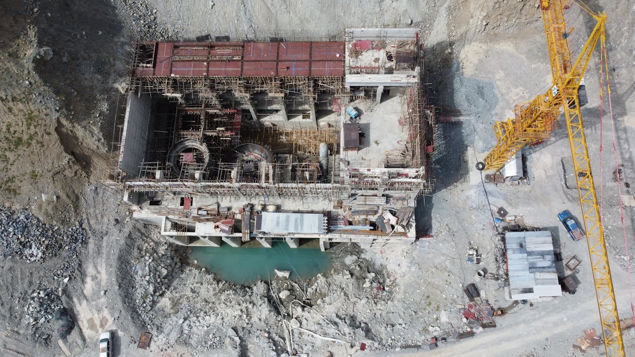
A construction site drone shoot is a professional aerial photography and videography service that uses unmanned aerial vehicles (UAVs) to document construction projects from elevated perspectives. This service captures high-resolution images and videos of your building site, providing comprehensive visual records of progress, site conditions, and structural elements.
Construction site drone photography serves multiple purposes including real-time progress monitoring, stakeholder communication, safety documentation, and future reference. Unlike traditional methods, aerial drone surveys offer faster data collection, enhanced accuracy, and cost-effective alternatives to helicopter photography.
Faster Documentation
Cost Reduction vs Helicopters
Site Coverage
Monitor construction phases with timestamped aerial imagery. Create visual records showing project advancement from foundation to completion.
Conduct aerial safety audits without personnel accessing dangerous heights. Identify hazards and compliance issues from elevated perspectives.
Share impressive aerial videos and images with investors, clients, and team members. Professional aerial content enhances project presentations.
Eliminate expensive helicopter photography costs. Drone aerial surveys provide similar high-quality documentation at fraction of traditional expenses.
Generate precise aerial maps with GPS coordinates. Use drone survey data for volumetric calculations, boundary verification, and site planning.
Create comprehensive visual records with timestamped aerial footage. Maintain legal documentation of construction milestones and completion evidence.
Pro Tip: Regular construction site drone shoots (weekly or monthly) create compelling time-lapse videos showing complete project transformation from excavation through final completion.
Professional construction site drone photography in India requires strict adherence to DGCA (Directorate General of Civil Aviation) regulations. Understanding these requirements is essential for legally operating aerial photography services.
| Drone Category | Weight Range | Registration Required | License Required |
|---|---|---|---|
| Nano | Under 250g | No (personal use) | No (recreational) |
| Micro | 250g – 2kg | Yes (UIN required) | Yes (commercial) |
| Small | 2kg – 25kg | Yes (UIN required) | Yes (RPL mandatory) |
| Medium | 25kg – 150kg | Yes (UIN required) | Yes (RPL + approvals) |
Important: Any commercial drone photography activity in Dehradun requires pre-flight permission from Digital Sky Platform. Operators must verify airspace zones (green/yellow/red) and obtain necessary clearances before conducting construction site drone shoots.
Weddings require flexible and well-planned photography coverage. Services are usually customized based on the number of events and days.
Candid photography captures natural expressions and spontaneous moments. It focuses on real interactions rather than posed images.
Cinematic films present the wedding as a visual story. Video footage is edited into a structured format with highlights from different events.
Traditional photography includes posed portraits and family group photographs. These images document key moments and attendees.
Drone shots and creative angles are often used to capture venue layouts and scenic surroundings, especially in hill locations.
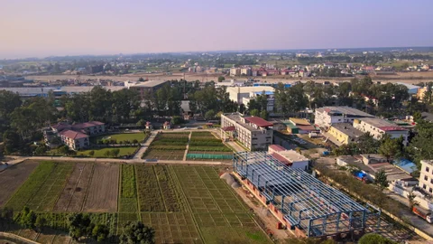
Construction companies use aerial photography to showcase residential and commercial development projects. High-quality drone videos and images enhance marketing materials, property listings, and investor presentations.
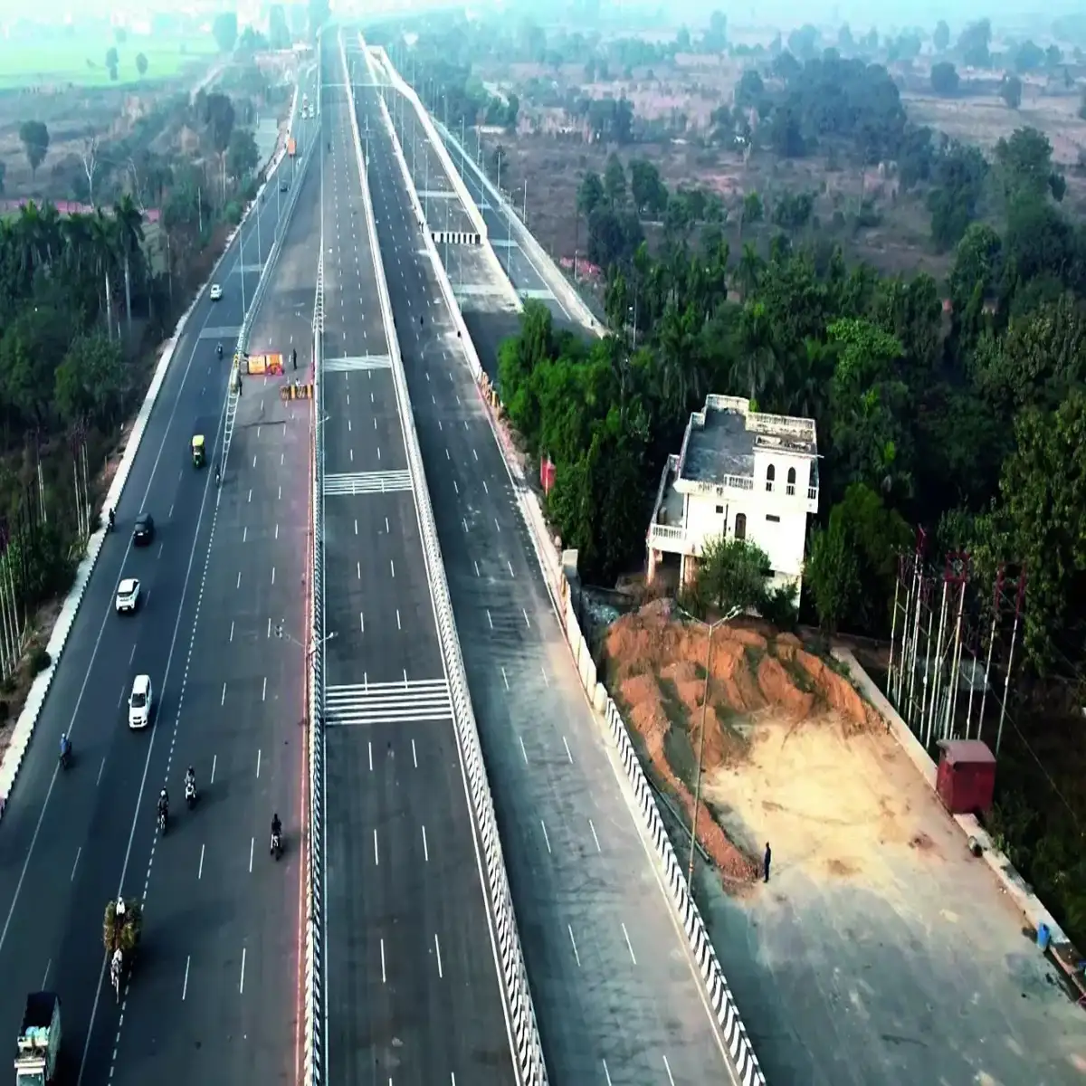
Large-scale infrastructure projects (roads, bridges, highways) benefit from aerial site surveys. Drone mapping provides accurate documentation of construction zones, environmental conditions, and project scope.
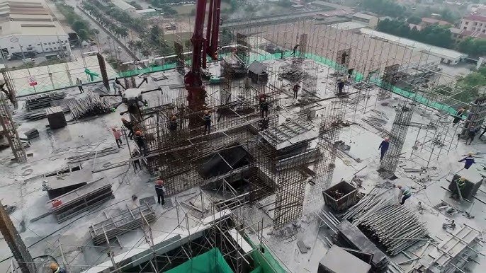
Multi-story building projects require regular construction site drone photography for progress monitoring, quality control, and stakeholder updates. Aerial perspectives reveal structural progress invisible from ground level.
Aerial drone surveys help identify safety hazards, environmental compliance issues, and construction site conditions. Certified operators conduct inspections without exposing personnel to dangerous heights.
Timestamped aerial imagery serves as legal evidence of project completion, condition assessment, and insurance documentation. Professional drone records prove completion date and site conditions.
Drone survey data enables accurate volumetric measurements of excavation, materials stockpiles, and earthwork. GPS-referenced aerial mapping provides precise site dimensions for planning.
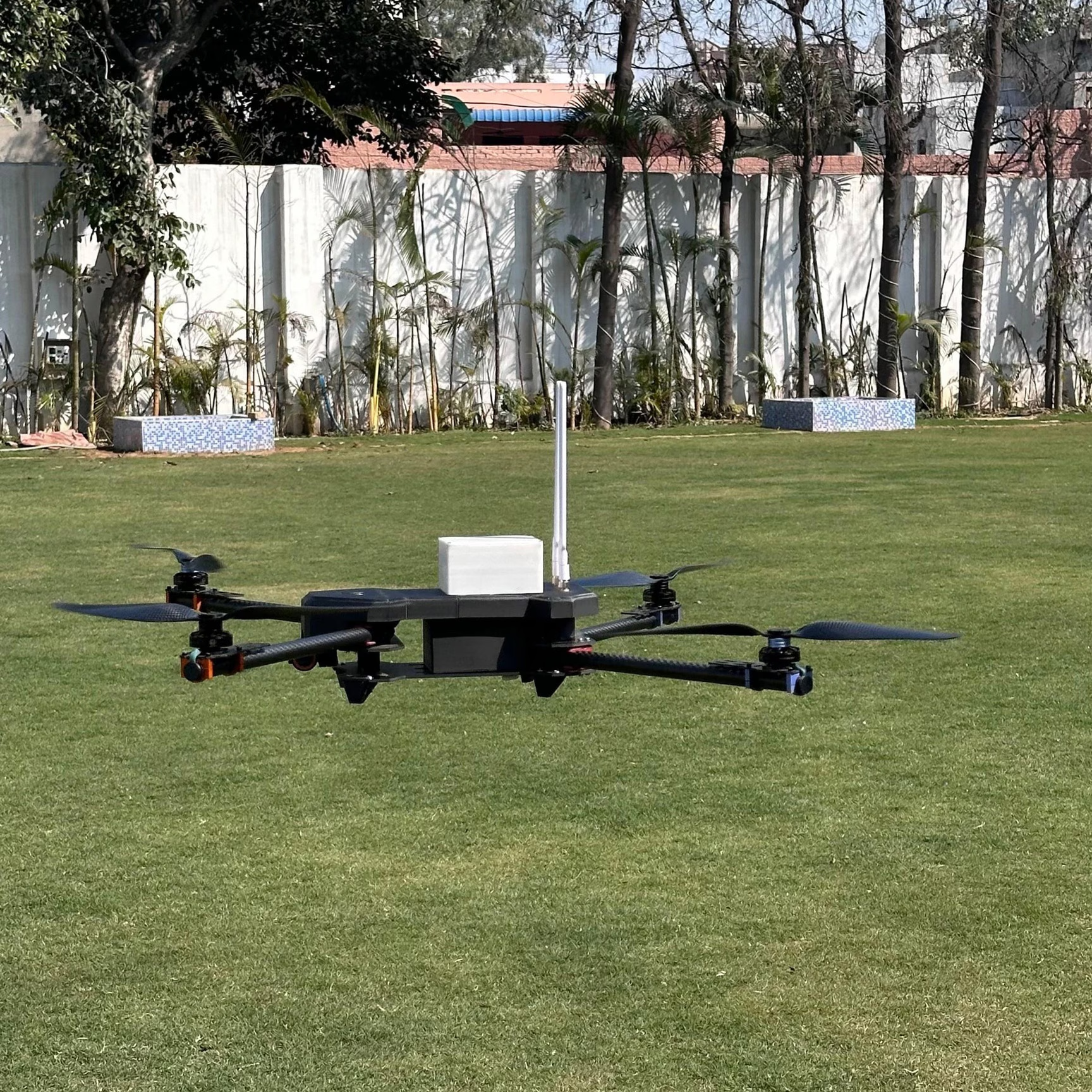
Professional construction site drone photography captures imagery at 4K resolution (3840x2160 pixels) and higher. Modern drone cameras record 48MP and 50MP still images with exceptional detail clarity. This resolution allows zooming and detailed analysis of construction elements from aerial perspectives.
Recommended frequency depends on project timeline and requirements. Most construction firms schedule drone shoots weekly or bi-weekly for active phases, monthly for slower progress periods. Time-lapse applications benefit from consistent weekly documentation showing transformation across construction phases.
Indian DGCA regulations limit recreational drone flights to 400 feet (122 meters) maximum altitude. Commercial operators may obtain special approvals for higher altitudes. For construction site documentation, 100-300 feet typically provides optimal perspective balancing altitude with image quality and detail visibility.
Yes, high-resolution aerial imagery reveals structural defects, material quality issues, construction irregularities, and compliance problems. Professional drone photographs enable detailed visual inspection of building facades, roofing, structural elements, and site conditions from elevated angles not visible from ground-level inspection.
Optimal drone shooting conditions require wind speeds below 25 km/h, clear visibility (minimal haze), and dry weather. Light winds (under 15 km/h) provide stable footage and sharp imagery. Severe weather, strong winds, heavy rain, and fog compromise flight safety and image quality.
Commercial construction site drone photography is legal in India with proper DGCA compliance. Site owners must grant permission for drone flights over their property. Operators require Remote Pilot License, registered UIN, liability insurance, and Digital Sky pre-flight permission. Always verify airspace zones and obtain necessary clearances.
Pricing varies based on site size, complexity, deliverables required, and frequency. Single aerial photography session starts at competitive rates. Monthly monitoring contracts, time-lapse videos, orthomosaic mapping, and 3D modeling carry premium pricing. Request custom quotes for specific construction project requirements.
Professional packages typically include 4K video footage, high-resolution still images, color correction and editing, GPS-tagged data, project timeline documentation, and client-ready deliverables. Advanced services include orthomosaic maps, 3D modeling, volumetric calculations, and custom video editing with branding.
![[CITYPNG.COM]Download HD Realistic Red Flower Rose PNG - 1500x1500](https://magicalclick.in/wp-content/uploads/2026/02/CITYPNG.COMDownload-HD-Realistic-Red-Flower-Rose-PNG-1500x1500-1.png "[CITYPNG.COM]Download HD Realistic Red Flower Rose PNG – 1500×1500")
Comprehensive analysis of construction site layout, hazards, no-fly zones, and optimal shooting angles. Operators identify safety considerations and airspace restrictions before flight operations.
Digital Sky Platform consultation confirming airspace status, obtaining pre-flight permissions, and verifying red/yellow/green zones. Insurance verification and DGCA compliance confirmation before any flight.
Professional drone calibration, gimbal setup, camera configuration, and weather assessment. Battery charging, safety equipment verification, and emergency protocol review.
Professional drone operators conduct smooth aerial flights capturing predetermined angles and perspectives. 4K video recording, still image photography, and data collection following planned flight paths.
Professional editing, color correction, stabilization, and enhancement of aerial footage. GPS data integration, metadata tagging, and delivery of polished 4K videos and high-resolution images.
Dehradun, the capital of Uttarakhand, presents unique challenges and opportunities for construction site drone operations. Understanding local factors is essential for successful aerial photography projects.
Dehradun’s proximity to defense establishments and Himalayan foothills creates specific airspace classifications. Some areas fall under restricted zones requiring special permissions. Professional operators maintain updated knowledge of local airspace restrictions and obtain necessary approvals from appropriate authorities before conducting construction site drone shoots.
Dehradun’s climatic conditions fluctuate seasonally. Monsoon season (June-September) brings humidity and occasional rains affecting flight conditions. Winter months provide optimal weather for stable drone operations with clear visibility. Professional scheduling accommodates seasonal weather patterns.
Dehradun’s varied terrain enables diverse aerial perspectives. Valley locations provide natural backdrops. Elevated construction sites benefit from panoramic aerial views. Operators leverage local topography for compelling construction documentation.
Important: Any commercial drone photography activity in Dehradun requires pre-flight permission from Digital Sky Platform. Operators must verify airspace zones (green/yellow/red) and obtain necessary clearances before conducting construction site drone shoots.
Transform your construction site documentation with professional aerial photography and DGCA-compliant drone services. Our certified operators deliver stunning 4K footage, high-resolution imagery, and comprehensive site analysis.
EXCELLENTTrustindex verifies that the original source of the review is Google. Nice work magical click team in my marriage anniversary thank you so much all the team .God bless youPosted on GoogleTrustindex verifies that the original source of the review is Google. I recently planned my girlfriend’s birthday photoshoot with Magical Click by Anthwal Studio at Hyatt Centric Dehradun, and overall it was a really great experience. Magical Click team is very professional and skilled in candid photography. They focus more on natural emotions rather than forced poses, which makes the pictures look very real and beautiful. Their storytelling style is one of their biggest strengths.Magical Click team helped with pose ideas, angles, and lighting, especially for a birthday theme shoot. Their creative direction made the shoot feel premium and well-planned.Posted on GoogleTrustindex verifies that the original source of the review is Google. After many years, we had the pleasure of meeting the Magical Click team again. A few years ago, they beautifully captured our wedding, and they truly are among the best photographers in Uttarakhand very creative and professional. This year, the Magical Click team covered my brother’s wedding, and it was once again a wonderful experience. It always feels great to see them working with such dedication. Even today, they remain extremely hardworking and maintain a very kind and professional behavior. Thank you, Anthwal Sir, and the entire Magical Click team for capturing my brother’s wedding so beautifully!Posted on GoogleTrustindex verifies that the original source of the review is Google. GoodVerified by TrustindexTrustindex verified badge is the Universal Symbol of Trust. Only the greatest companies can get the verified badge who has a review score above 4.5, based on customer reviews over the past 12 months. Read more